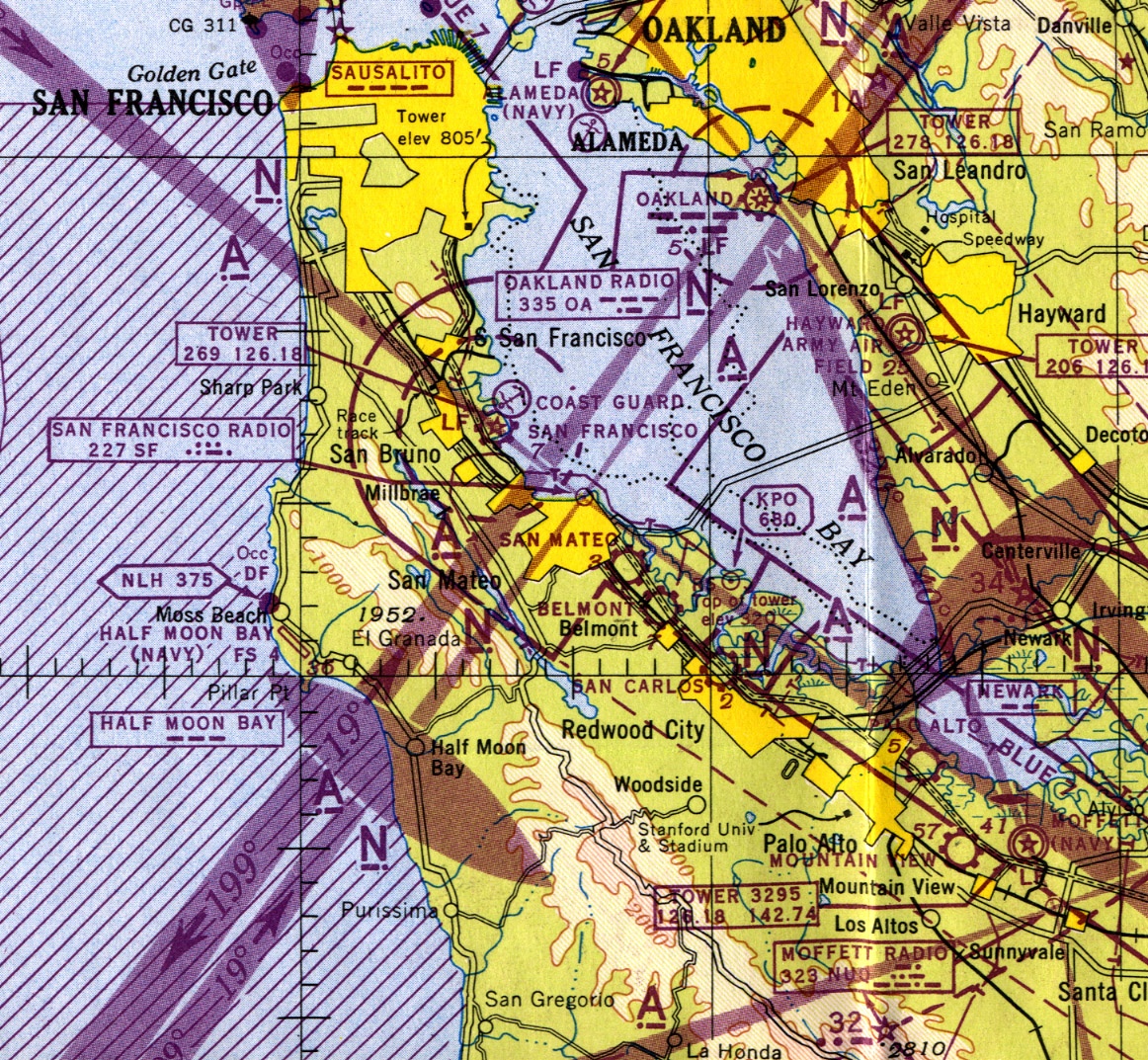
The following image from the San Francisco Sectional Aeronautical Chart from sometime in the 1950’s shows the locations of the San Carlos, San Mateo, Belmont, Mountain View, Palo Alto, Moffett, Hayward Army, Oakland, Alameda, Half Moon Bay, and San Francisco airports.
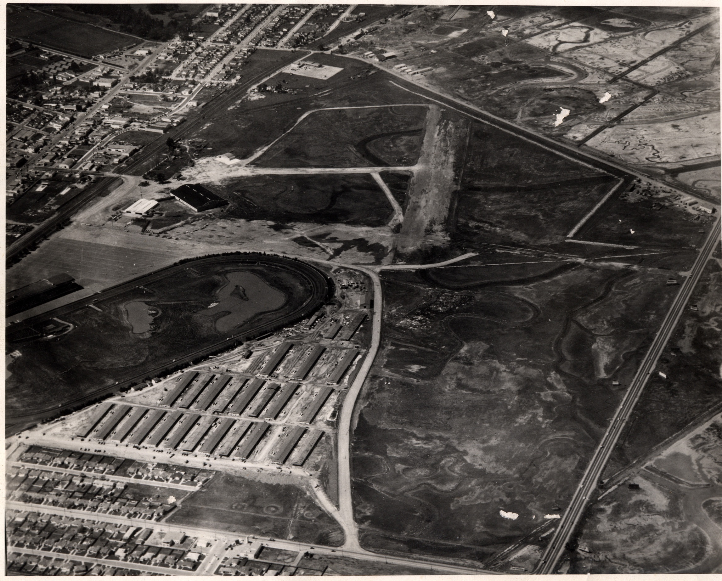
The following image shows the airport near the previous site of the Bay Meadows racetrack. It could be the San Mateo Airport referred to on the above Sectional. If you have any information about that, please contact webmaster at sancarlospilots.org.
The following image shows the Redwood City Airport from sometime in the 1920’s or so. That’s Chestnut Street on the lower left. According to the following newspaper articles, the airfield and hangars were located near the intersection of Chestnut St. and Veterans Blvd. on the site of today’s Redwood City Corporation Yard.
If you have more information, please contact webmaster@sancarlosairport.org.


If you have any comments on these photos or if you have classic photos of Bay Area Airports that you’d like to add to our collection, please contact webmaster at sancarlospilots.org. We can scan photographic prints if necessary.